a study of socioeconomic change along seattle’s transit corridor
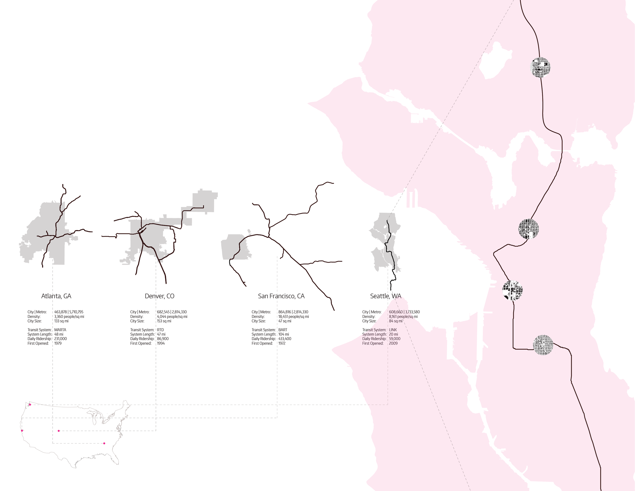
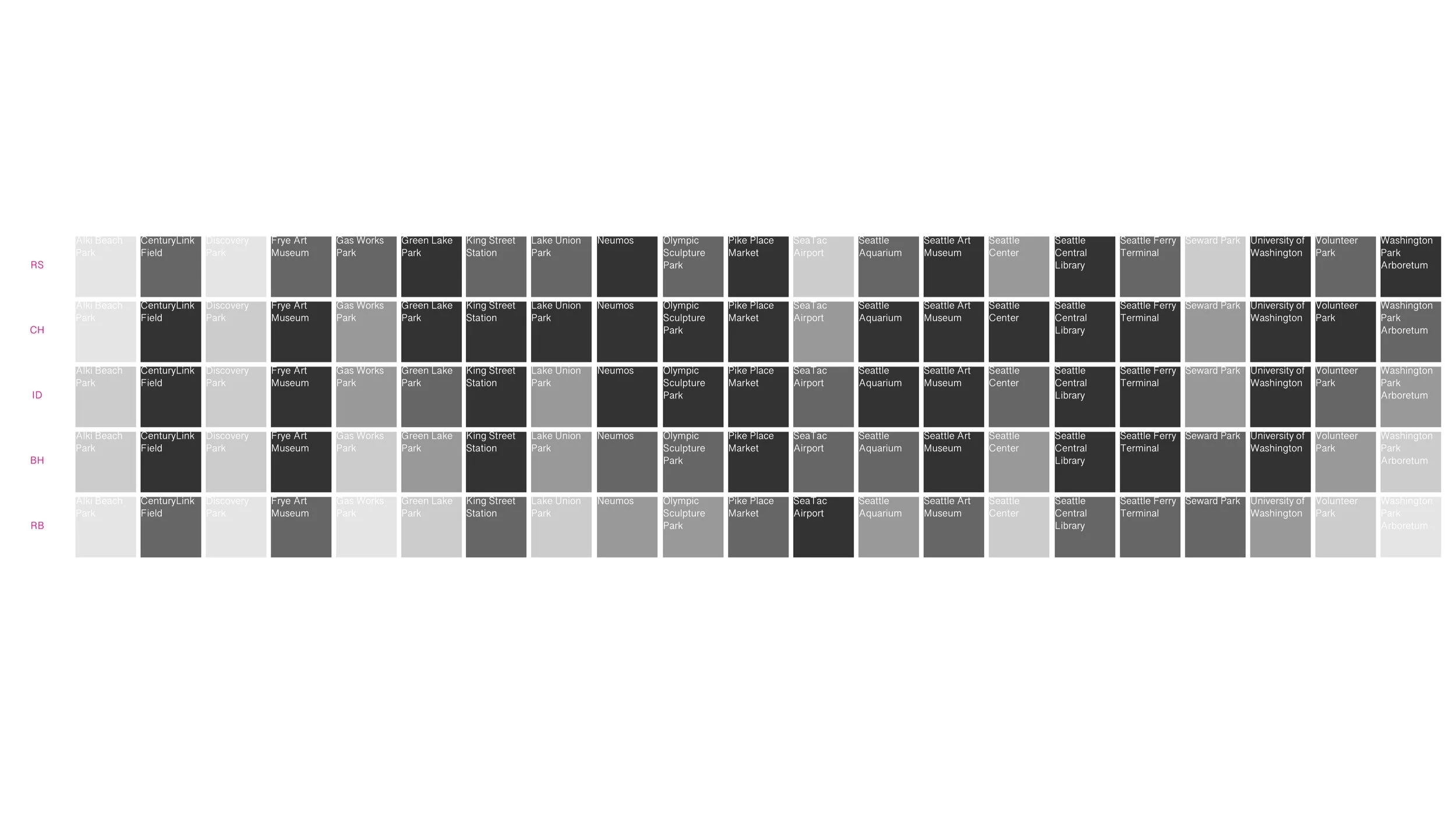
this series of mapping exercises sought to find correlations between a current spatial social issue. using gis data, the issue at hand was the increase in costs of living as linked to the placement of transit stations. the study focused on seattle, a rapidly growing city in the process of expanding its light rail transit network, using five stations along the light rail line with varying socioeconomic qualities. what effects does the introduction of a transit station have on the surrounding neighborhood? how are densification, gentrification, and access to the rest of the city related to the placement of transit stations?
university of washington, department of architecture. instructor: gundula proksch. teammates: sarah chan and jesslyn howard. contribution: concept, research, gis mapping, diagrams, graphic design.